Glödis via ferrata route

The most important at a glance

difficulty
🞽
B
length
400 m
duration
1 h
exposition
🔋
SO
sea level starting point
🔋
3206 m
sea level entry point
🔋
2970 m
sea level highest point
🔋
3190 m
access time to the entry point
4 h
walking time descent
3:30 h
state: closed
best season:
MAY, JUN, JUL, AUG, SEP
access:
Starting point is the car park at Seichenbrunn in Debanttal – via the Alpine road or the educational nature trail to Lienzer Hütte – on the signposted route to Leibnitztörl, then take a detour to Kalser Törl (signposts for Glödis) – to an altitude of around 2500 m, bear right again – then head up to the start of the south-east ridge (approx. 2970 m)
descent:
As the ascent.

arrival

Car park
Car park Seichenbrunn

altitude profile

Pdf file

Gpx file

Interactive map

Current weather conditions

Sonne-03.png
0°C/32°F °C

Description

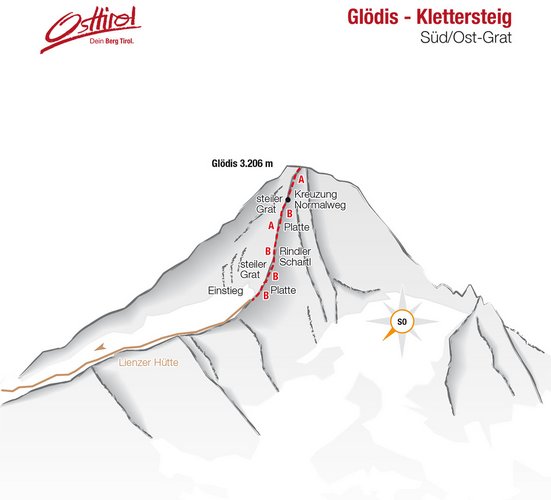
A fantastic panoramic view from the loveliest summit of the Schober group is the reward for the longer climb. The via ferrata route is not that difficult, the length of the tour and the thin air above 3000m does however require a good level of fitness and mountain experience.


This via ferrata route is the finish of a high alpine mountain tour. The weather can change very quickly here (check your equipment!). Equipment: Complete via ferrata equipment and helmet. Crampons, ice pick and an additional safety rope for spring and winter climbs.


Topos


Newsletter

Subscribe to our newsletter and receive the best tips every month for current offers, mountain tours, events and much more.