Allmaier Toni via ferrata route

The most important at a glance

difficulty
🞽
B/C
length
900 m
duration
1:30 h
exposition
🔋
NO
sea level starting point
🔋
2539 m
sea level entry point
🔋
2260 m
sea level highest point
🔋
2520 m
access time to the entry point
3:30 h
walking time descent
2:30 h
state: closed
best season:
JUN, JUL, AUG, SEP, OCT
access:
Starting point gorge bridge – to the Kerschbaumeralm bothy – continuing to Zochenpaß, where the path begins.
descent:
Via 'Hans-Falkner Weg' (standard route) to Weittalscharte – Kerschbaumeralm-bothy – gorge bridge.

hut/alpine hut

altitude profile

Pdf file

Gpx file

Interactive map

Current weather conditions

Sonne-02.png
10°C/50°F °C

Description

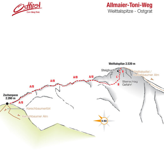
Lovely via ferrata route on the jagged eastern ridge of the Weittal summit. The trail is well signposted (red dot with a blue edge). The initial flatter section is somewhat easy and ends at the so-called 'Barbaraplatzl'. In the following, steep rock face (difficult) you finally come to the key point in the shape of a smooth ledge.


Topos


Newsletter

Subscribe to our newsletter and receive the best tips every month for current offers, mountain tours, events and much more.